Mountain Digital Survival Guide: Preventing Cold Battery Drain & Mastering Offline GPS Maps & SOS
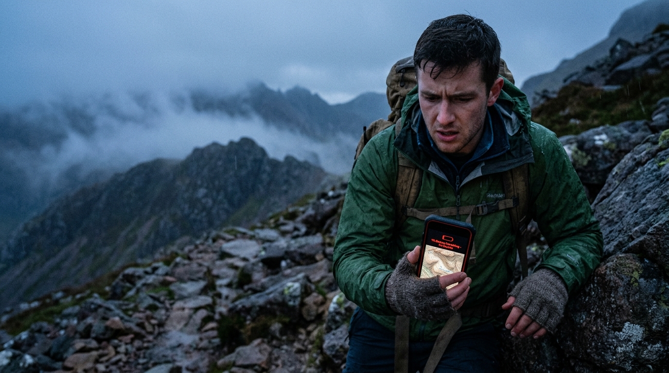
- 1Explains the rapid battery drain mechanism in deep mountain valleys with no cellular reception and sets the golden rule for switching to Airplane Mode.
- 2Provides a complete guide to offline map caching and utilizing the smartphone's standalone satellite GPS chipset even when 5G/LTE is dead.
- 3Features emergency rescue protocols including reading Korea's National Point Control Numbers, 119 rescue app location dispatch, and a 5% battery survival routine.
1. [Battery Survival Science] Low-Temperature Lithium-Ion Voltage Drop & 3-Step Defense
| Environmental Condition | Drain Rate & Voltage Drop | Internal Smartphone Impact | Risk Level | Trail Action Protocol |
|---|---|---|---|---|
| Room Temp (20℃) | Normal discharge (3-5% / hr) | Optimal electrolyte ion mobility | Very Low (Stable) | Standard battery saver mode |
| Cold Exposure (0℃ ~ -10℃) | Rapid drain (20-40% / hr drop) | Electrolyte viscosity increases, internal resistance surges | High (Sudden Shutdown) | Keep phone in inner chest pocket (36.5℃ body heat) |
| No Service Area (Deep Valleys) | Full power antenna hunting (>30% / hr) | Cellular module maximizes transmission power continuously | Extreme (Dead in 1-2 hours) | Switch to Airplane Mode immediately when signal drops to 1 bar |
| Direct Heat Pack Contact | Abnormal overheating & pressure buildup | Gas expansion, battery pouch swelling | Critical (Explosion & Fire Risk) | Wrap heat pack in cloth; never touch battery directly |
2. 📶 Preparing for Zero Cellular Coverage: Offline Maps & Standalone GPS Setup
- Standalone GPS Chipset Autonomy: Your smartphone's GPS/GLONASS satellite receiver operates completely independent of cellular networks (LTE/5G) or Wi-Fi. As long as you have pre-cached offline maps, you can accurately track your live location anywhere in deep ravines without signal.
- Pre-Caching Topo Maps & GPX Tracks: Before heading out, download the contour map of your target mountain on hiking apps (Sangilsaem, Trangle, Rambler, or Korea National Park Smart App) and import the GPX track to enable off-trail alerts.
- Limitations of Standard City Map Apps: General navigation apps often lack detailed 1:25,000 topographic contour lines and rocky trail details. Always use dedicated mountain topo apps for backcountry hikes.
- Airplane Mode Golden Rule: The moment cellular reception drops to 1 bar or switches to 'No Service', turn on Airplane Mode immediately. This prevents the phone from frying battery on cell searches while preserving GPS positioning.
3. 🆘 Distress Rescue Coordinates: National Point Control Numbers & Emergency SOS
- Reading Yellow National Point Control Signs (2 Korean letters + 8 digits): Found on yellow metal trail markers every 100-500m across Korean mountains (e.g., 'Dasa 1234 5678'). Quoting this 10-character code to 119 pinpoints your exact location within 10 meters for rescue helicopters.
- One-Touch 119 Rescue App GPS Dispatch: When voice calls break up due to weak signal, open the 119 Rescue App and hit emergency report. It transmits your latitude and longitude coordinates directly into emergency dispatch systems.
- Emergency SOS Shortcut Setup: Configure your smartphone to automatically dial emergency services and send your live GPS link to designated emergency contacts upon pressing the power button 5 times in rapid succession.
4. ⚡ 5% Battery Life Survival Protocol
- Ultra Power Saving & Grayscale Display: Lower brightness to minimum, switch display to grayscale, and block all background app refresh to reduce standby power consumption by over 90%.
- Body Core Pocketing: Store both your phone and power bank inside your inner mid-layer chest pocket to keep them warm against your body (36.5℃) and prevent voltage drop.
- Scheduled Hourly Power Cycle: If stranded and awaiting rescue, power on your phone for only 2 minutes at designated times (e.g., every top of the hour) to check for messages, then power off immediately.
Common Rookie Mistakes & Proven Solutions
Smart Buyer's Guide: Emergency Safety & Essential Gear
- •❌ Relying solely on smartphone flashlight (drains battery and occupies hands)
- •❌ Pea-whistles with moving balls (freezes or jams with moisture during emergencies)
Essential safety setup for every day hiker
Sunrise/sunset chasers and all-season mountain trekkers
- ✓🔍 Headlamp with verified ANSI-FL1 lumen and runtime ratings
- ✓🔍 Pealess high-decibel whistle operable in wet/freezing conditions
- ✓🔍 Tear-resistant aluminum emergency thermal blanket (sub-50g)
Essential Hiking & Trail Glossary
Korea's standardized 10-character grid coordinate system (2 Hangul characters + 8 digits) used to identify unaddressed mountain and coastal wilderness locations.
Built-in smartphone hardware sensor that directly receives satellite signals (GPS, GLONASS, Galileo) to determine real-time position without any cellular data connection.
The universal XML format used to store waypoints, tracks, and elevation profiles for hiking navigation apps.
Internal gas buildup in a lithium-ion battery caused by extreme overheating or rapid temperature shock, expanding the battery pouch.
Recommended Korea Mountains for this Guide
Seoraksan (Seoraksan)
Deep ravines like Dinosaur Ridge and Cheonbuldong Valley have frequent cellular dead zones where offline maps are critical.
Jirisan (Jirisan)
Long-distance ridge traversing requires strict cold battery preservation and National Point Number awareness.
Bukhansan (Bukhansan)
Rugged rocky ridges like Uisang Ridge and Hidden Wall feature dense National Point Number signs for 119 mountain rescues.
Interactive Trail Safety Checklist
Tap each item before departing to verify readiness.
Generational Hiking Guide Series
Kids Trail Gamification & Scavenger Hunt
3 rules to turn early whining into joyful nature exploration
Couples Hiking Date & 10-Min Myth Guide
Pacing strategies, secret comfort gear, and scenic date peaks
4050 Spine Decompression & Fat Burn
Protecting lumbar discs while maximizing visceral fat loss
Hiking with Elderly Parents & Medical Kit
Barrier-free boardwalks, anti-shock poles, and medical safety